Smooth Sailing This Week.
A MUCH ANTICIPATED PRE-SPRING BREAK
After a wacky and a tragic giant of giant rain & wind storms this past weekend, that caused 7 deaths and over 10 inches of rain in parts of the mid atlantic and northeast, the seas are calming down and the sun is coming back out. Let’s give all those victims our thoughts and prayers. Just awful how devastating this storm was for many people. On a much brighter note, much of this week will feature tranquil conditions along with spectacular wall to wall March sunshine. Below is a computer model chart showing just how warm it will get by this weekend!
The chart below show’s possible temps by next Monday. Notice how much of the big cities from mid atlantic to the northeast may still be well above normal and northern new england starts to get cooler, if this model verifies.
Looking at our current pleasant weather, there is no reason not to believe it will continue to be warm until next Monday for much of the mid atlantic. The computer model run below shows how a cold front approaching from the west will bring rain and a change to chillier weather behind the front. The last week of Winter will be warmer than the first week of Spring for much of the country.
A change in the weather pattern again next week will open the gates of Winter for one last gasp (hopefully the last for most of us). By Monday night into Tuesday, a storm may develop along the cold front ushering in the colder air. Below is today’s computer model run showing the colder air and possible snow from western PA over to northern new england by Tuesday morning.
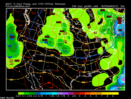
If this model would verify, it would give our swing into Spring a big step back into Winter. Rain would change to snow over much of the interior mid atlantic up thru northern new england. I must caution you not to get overly worried just yet as the model run below from last week, predicted a blizzard for this upcoming Friday and we know that is not going to happen. Are you ready for a big laugh? Look below and remember, it’s for this Friday, which will be the opposite from the computer run you’re about to see.
LET’S NOT ROCK THE BOAT FOR NOW
Just get outside this week and have fun in the sun and let me worry about any stormy seas that may appear next week. Stay tuned on this potential winter storm for next week (maybe that model was just off a few days-just kidding people!). You are better off just lighting up the grill this week, and keeping the snow blower ready for next week, just in case.
David (SnoBoy) Claghorn
E-mail me: clagville@comcast.net
Become a fan of: SnoBoy Weather on Facebook.
Northern New England Weather Center


Leave a comment